

NGA
- North America
- Central, South America
- Western Africa, Mediterranean, Black Sea
- Eastern Africa, Southern Asia
- Australia, New Zealand, Indonesia, Papua New Guinea
- South Pacific Islands
- Eastern Asia, South Eastern Russia, Philippines
- Other Regions
Canadian
Caribbean and Mediterranean
Norwegian
SHOM
SEMAR
U.S.
Search by chart title, key word or chart number:
International Charts
 Nearly 1,000 charts worldwide
Nautical charts serve as a valuable complement to electronic systems —and critical back up when the unexpected happens. Nautical Charts Online sells both National Geospatial-Intelligence Agency (NGA) charts and Norwegian Hydrographic Service (NHS) charts. These charts provide commercial and recreational mariners with critical navigational information for international waters.
Search NGA charts for international waters
- North America
- Central, South America
- Western Africa, Mediterranean, Black Sea
- Eastern Africa, Southern Asia
- Australia, New Zealand, Indonesia, Papua New Guinea
- South Pacific Islands
- Eastern Asia, South Eastern Russia, Philippines
- Other Regions
Search CHS charts for the Canadian waters
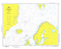
Search NHS charts for the Norwegian coast, including polar waters
Search Imray charts for Caribbean and Mediterranean waters
Search SHOM charts for European and International waters
Search SEMAR charts for the coastal waters of Mexico
I need a chart for U.S. waters

©2025 Nautical Charts Online, All Rights Reserved.